CatronCountyWalk

Catron County, New Mexico has about 400 miles of paved road, and we're planning to walk every mile of it ... eventually ...

Thursday, May 26, 2005

Forest Road 141 Revisited

Caleb Smith was in Albuquerque, giving a talk, and I missed it. Too many things piled up - kids and 4-H events and a sick donkey and a friend needing her animals fed while she went away (we have a reciprocal arrangement, and it was my turn.) I couldn't figure out how to squeeze a 6-hour roundtrip car ride to Albuquerque into the available windows of time, so I went walking instead. I planned an evening walk knowing I was going to miss meeting Caleb in person, and thinking I was fine about it, but I'm still kind of out of sorts and cranky. Living out in the country and being a stay-at-home homeschooling mom is great, I wouldn't trade it for anyone else's life, but it can be a little frustrating to be so tied down by the requirements of children and animals. This walking project has been such a great antidote for frustration and restlessness - I really wanted to thank Caleb in person for inspiring me to begin it, and give him a hug, and I really would have enjoyed listening to his talk. I hope he had a big enthusiastic crowd.

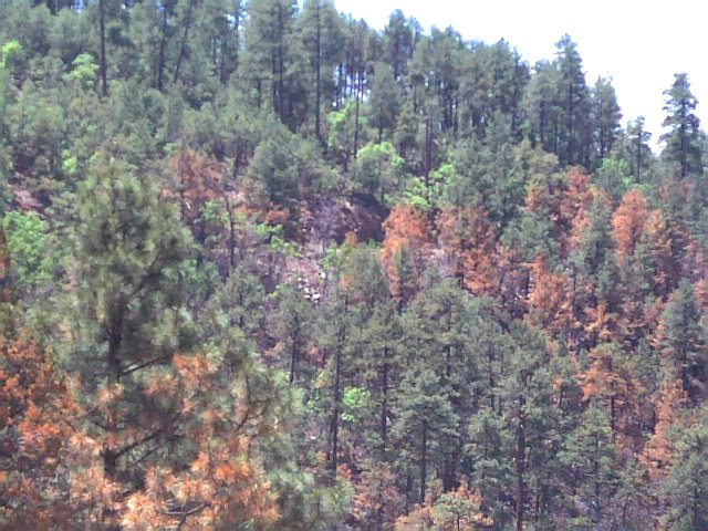
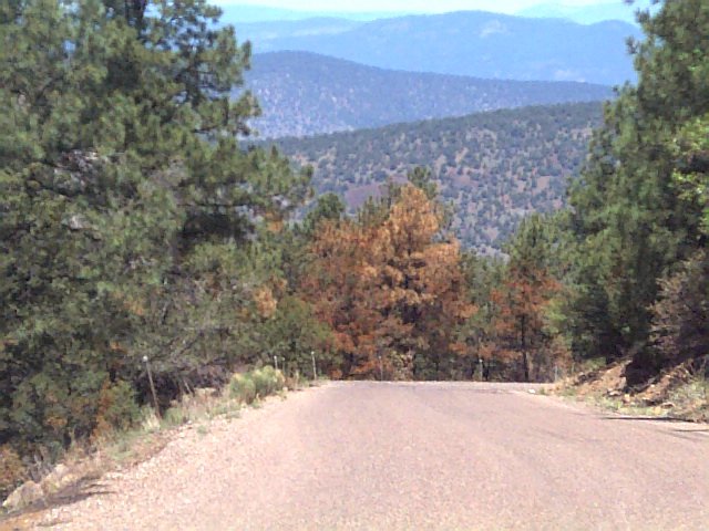
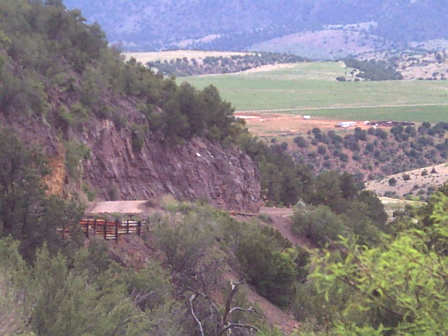
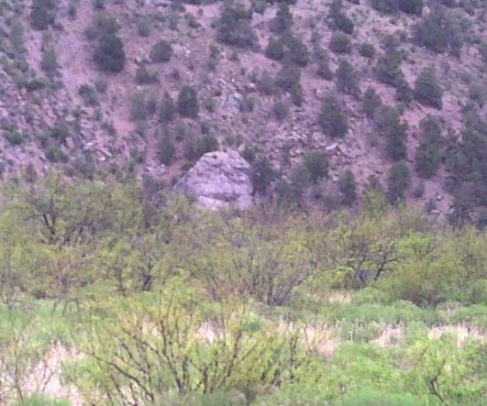
So, we headed out after chores, when the day was just starting to cool off, up to the end of 141. Three dogs, two kids, two adults. Not really much to say about the walk, except that we had a long uphill slope that went on forever, saw only two other vehicles the whole time, and one elk, and one of my dogs got on the trail of something and didn't come back to find us until we were done walking and were driving one vehicle back to the end where the other was parked. It was getting dark, and I think Cynthia was more worried than I was that my dog was lost in the woods or had been eaten by a bear - I wasn't planning to start worrying until the last minute, but it was kind of contagious.

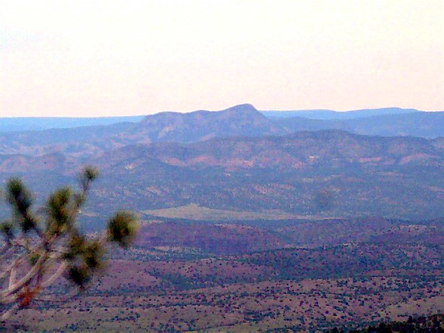
Saw more animals on the drive home than while we were walking - Cynthia had a close encounter with a deer and saw a fox, and there were elk everywhere on 12 between Reserve and Apache Creek.

So, Forest Road 141 is done, at least all 18.8 miles of actual pavement. Only about 115 miles of paved road left for us to walk in Catron County...

Wednesday, May 25, 2005


FR-141-4 We're parked down there some where. Posted by Hello

FR-141-3 with my dog Maia (aka Smiley) Posted by Hello

FR-141-2 Posted by Hello

FR-141-1 Posted by Hello

Forest Road 141

Wednesday, May 25 - We hiked 6.5 miles on FR 141 today, sometimes up, sometimes down, hemmed in at times by tall Ponderosa pines, with the occasional gorgeous vista thrown in, like the one shown above. This is an area where they have been doing prescribed burns, and it was sometimes weird to look at. The forest floor in places was completely black, with burnt stumps sticking up everywhere, and trees left standing, some which escaped getting scorched and others which weren't so lucky and had all their green needles turned to brown and orange.

The wildlife we saw today was small, but plentiful. A Gambel's quail, an Acorn woodpecker, many rabbits, squirrels and chipmunks, and a fox. That was the first fox I've seen alive - I've seen a few as roadkills. It was rather beautiful. There might have been bigger animals back up there, but we weren't likely to see them with the dogs crashing about.

We set a pretty good pace, in spite of the heat. Even with stopping to take pictures and giving the dogs some water every mile or so, we're closing in on three miles per hour. Also, time was when I would have had to stop after about 3 miles to have a snack, "to keep me going," so it's nice to feel as though all this walking is slowly changing me.

I think I've talked Cynthia into walking in the evening - my favorite time of day in New Mexico in the summer - so we'll finish 141 tomorrow.

Sunday, May 22, 2005

Slightly puzzled

I got ahold of the recent DVD release of My Name is Nobody, popped some corn, opened a Dr. Pepper, and sat down to watch the movie, expecting to see Mogollon in all its rugged mountain glory. It turns out that it would have been more accurate to say that small parts of the movie were filmed in or near Mogollon. In fact, it seems to have been filmed all over the state, and Fonda and Hill pop up in places which even Afleet Alex (winner of yesterday's Preakness) couldn't have made it to in the short amount of time indicated - Acoma Pueblo one day, White Sands the next. New Mexico is a huge state.

I have a friend who used to belong to the now apparently defunct Catron County Historical Society, which apparently played a part in getting Sergio Leone and company to use Mogollon in the film. She visited Mogollon during the filming, but never met Henry Fonda or Terence Hill, and never saw the actual movie. I'm going to have to get her to watch it with me and tell me what she remembers about the whole thing. I wonder what happened to the Historical Society?

A Walk was scheduled for today but I weaseled out of it. Too hot, and besides, I have to keep an eye on the Euro. Currency traders who have been short the USD and long on the Euro have been watching in puzzled amazement at the apparent "strength" of the dollar in the face of all evidence to the contrary - geopolitical risk, economic data, everything points to dollar strength being unsustainable, especially with Greenspan retiring in January. I'm just waiting for all hell to break loose, although I could be waiting for a while - trading has seasons as well, and we're headed for the summer doldrums.

My other reason for weaseling out of walking is that the alibi is having a short fiction contest, entries to be no longer than 117 words, and three very very short stories are floating around in my head - I want to get them down before I lose them.

Monday, May 16, 2005


Updated map. Posted by Hello

Not a very wide road. Posted by Hello

Cool view from the top. Posted by Hello

Looking back in the direction of Mogollon. Posted by Hello

Do you see a face too? Posted by Hello

Mogollon

Saturday 5/14 - we walked the Mogollon Road. Starting at Highway 180, the road climbs for three miles, crosses a green mesa for another mile, climbs for another three miles, and then drops down two miles into the old mining town of Mogollon. If you've ever seen the old spaghetti western My Name is Nobody with Henry Fonda and Terrence Hill, you've seen the town of Mogollon. Very cool little place. The pavement ends now about a quarter mile from the 9 mile marker, but at one time apparently the road was paved all the way through the Gila National Forest over to Beaverhead.

We wanted to spend more time walking downhill than up, so we parked in the middle of town, walked to the end of the pavement, and turned around. Dawdled through town, and then up a series of switchbacks for almost two miles - hard work. Going downhill we startled a small deer, and saw quite a few very fat squirrels, and some lizards. I brought two bottles of frozen water, which melted quickly into lukewarm water.

At the top of the mountain I was struck by something about Catron County - how when I was walking on 12 across the Plains of San Augustin at winter's end, the landscape made me think of African savannah, but walking down the side of a mountain in midspring, I thought it looked a little like we could have been in New Zealand.

Mogollon - J.P. Holland General Store Posted by Hello

Mogollon - museum Posted by Hello

Mogollon - theatre Posted by Hello

Mogollon Posted by Hello

Friday, May 13, 2005

GPS mishap

Yesterday we walked 3 miles on a dirt track connecting Hwy 12 to Hwy 32 - very nice little hike. No cars, no hot pavement, the dogs ran free and a good time was had by all. Doesn't count toward the goal, but oh well. I'm just posting today because I'm adding a link to a cool site I just found out about, http://www.sandiahiking.com/. The site belongs to a guy named Coltrin, and in it he descibes hiking all the trails in the Sandias over the course of a year - I found out about it by reading a review of the book he just had published, called Sandia Mountain Hiking Guide, in Albuquerque's weekly alternative newspaper, the alibi. (www.alibi.com) If I lived in Albuquerque, I'd definitely want to hike all those trails.

One of the neat features of the website are the 350 GPS waypoints that Coltrin has recorded on the trails.

Sad story about experiment with GPS. I bought my husband a Garmin GPS dealie for his birthday last year, and noticed it a while ago, still in the box - he hadn't had a chance to play with it at all. So I borrowed it. I thought it would be very cool to be able to add GPS info, and altitude changes, and to be very exact about mileage covered, for the blog.

The first time you use it, you have to leave it out in the open under the sky for 15-20 minutes, so it can do little mental calculations and triangulations and figure out exactly where it is. I left it on the roof of the car - didn't want the animals to munch it. Forgot about it, drove off, and the poor thing bounced off the roof of the car onto the asphalt at about 35 mph. It didn't survive the experience.

I ordered an identical replacement from Amazon.com, but three weeks later they tell me they just can't find it anywhere. I'm still searching the web, but I have a feeling this particular model is no longer available - so I'm going to have to get a different one, and tell my husband what an airhead I was. My horoscope has been saying things along the lines of "material things are slipping from your grasp." First the GPS, and last night an entire glass bowl of freshly made high-fiber no-cal chocolate guar gum pudding. What next?

Wednesday, May 11, 2005

Excuses, excuses

The Walk engine seems to have stalled. To continue on 36 north of Quemado requires big blocks of time, which I don't have enough of lately. If we have to drive an hour to get there, and in Cynthia's case, use a half a tank of gas getting there and back, it would be better to finish it in two trips rather than three. That means walking 7.5 miles rather than 5 miles each time, as there's about 15 miles left on that road until it reaches the county line. That means I need to have a 6 hour block of time - 2 hours driving time, 3 hours walking time (including breaks and picture taking) and 1 hour of fudge time, just in case.

(Warning - this could be very boring - I'm just trying to get across the logistical aspects of the walk, which can detract from the Joy of Walking, if allowed to.)

Even if we made three trips and walked 5 miles each time, I'd still need a walking window of 4 to 5 hours each time (2 for driving, 2 for walking, 1 for fudge factor,) which is why we're not walking three or four times a week these days - not enough walking windows like that opening up. Also, gas prices are getting prohibitive - at least to us Americans, who are looking at $3/gallon with shock and awe.

I've suggested to Cynthia that we consider taking bikes, and doing the 15 remaining miles of Hwy 36 in one fell swoop. She's not sure about that, and neither am I. Walking is safer, but slower. Riding is still fairly slow, at least the way I do it, but my original intent was to WALK all the paved roads in Catron County, not bike them. I was planning to save the biking for when we had run out of paved road - I thought the next plan would be to bike the unpaved roads, at least the better ones. Once you start to deviate from the plan, you never know what's going to happen - next thing you know, we'll be building ultralights or strapping on powered parachutes and flying over the roads, and our feet will never even touch the pavement - and then where would we be, I ask you.

There are at least two ways to look at it: by switching to bikes, we'll be exhibiting flexibility in the face of rising gas prices and time constraints, OR we'll be abandoning the original plan and therefore failing to actually complete our goal. The original plan might be flawed in that it relies so heavily on consumption of fossil fuels (which runs ironically counter to the beauty of walking, no?) I bet Citywalkers don't have this problem.

It's moot, for now - this weekend the Mogollon Road walk is back on, and next week they'll probably be done with the prescribed burns on 141, so we'll get that done and then see.

Saturday, May 07, 2005

Kentucky Derby Day

Yesterday, 5/6, we drove up to Quemado and walked the first 5.1 miles on Highway 36. There's no such thing as a bad walk, but this one came close to sucking - there was a constant wind of at least 15 miles an hour in our faces the whole time, with gusts up to at least 25mph, with accompanying grit. I forgot the camera, but it wasn't a great day for picture-taking.

Also, I'm sort of at the point where I am wishing, at least a little, that I could walk alone every once in a while. Having a walking partner is a great thing - there's safety in numbers, there's the company and the sense of shared effort, there's all the wonderful things that a partner brings to the endeavor, like dedication, and a second vehicle. There's also those times when you crave independence, or at the very least, quiet.

On the bright side, we walked 5 miles faster than we've ever walked 5 miles before, and we had a nice meal at El Serape Cafe in Quemado, reasonably priced, excellent service, and the chicken enchiladas were very good, as was the fried ice cream.

On a different note, if I have to listen to another schmuck make a joke about how I'm the county's official streetwalker, I'm going to use him for target practice. There seems to be a certain kind of asshole who thinks this is a cute remark. Usually over the hill, white, male and voted for Bush. Go figure.

Thursday, May 05, 2005


Updated map, showing 141. Posted by Hello

Rx for fire

Our walk today was shortened due to a "prescribed" fire on 141 south of Reserve. If you don't know what that is, it's when the Forest Service sets small fires in the forest to prevent large fires later during fire season. We left Cynthia's truck parked near mile marker 4 and were planning to drive up to mile marker 9, find a place to park the van and start walking back, but only got 2.1 miles up the road before running into smoke and fire fighters. So, 2.1 miles today. We intended to walk 159 to Mogollon this week, but changed the plan to walk 141 first.

Since they are doing prescribed burns back thattaway, we're having to change our plans again, and tomorrow's walk will be, hopefully, the first five or so miles of Highway 36 north out of Quemado. I have to say, it's hot and getting hotter, and distances walked may get shorter again 'til we get used to the heat sapping our energy, and having to carry lots more water. We'll probably not walk during June and July, especially if all we have left is Route 60, which is out in the open, not much cover, and could be brutally hot in the midsummer sun.