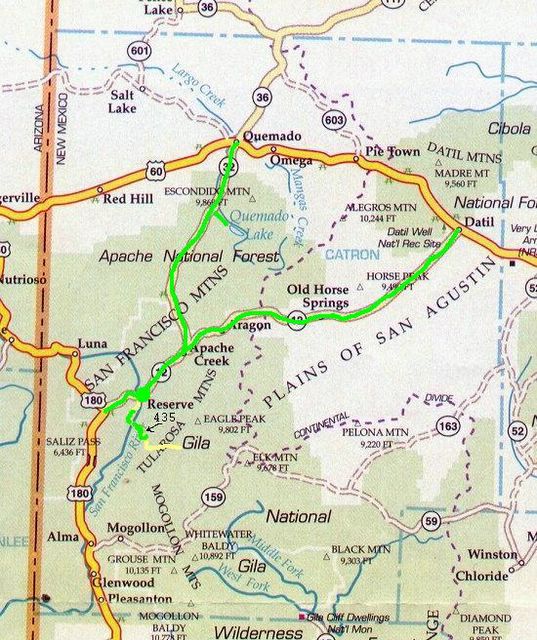
CatronCountyWalk

Catron County, New Mexico has about 400 miles of paved road, and we're planning to walk every mile of it ... eventually ...

Thursday, March 24, 2005

Down to Pleasanton

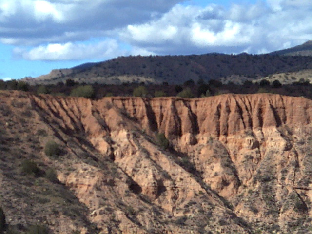
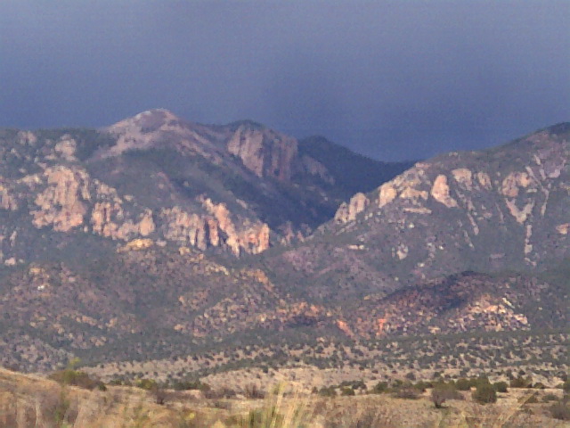
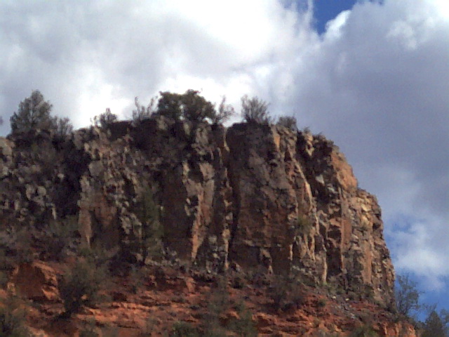
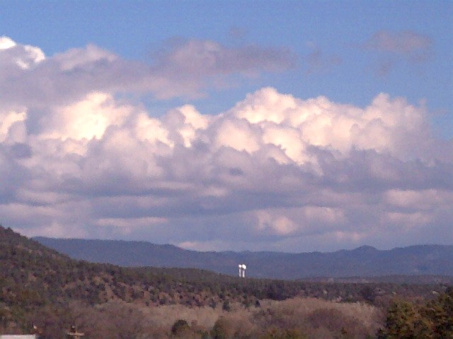
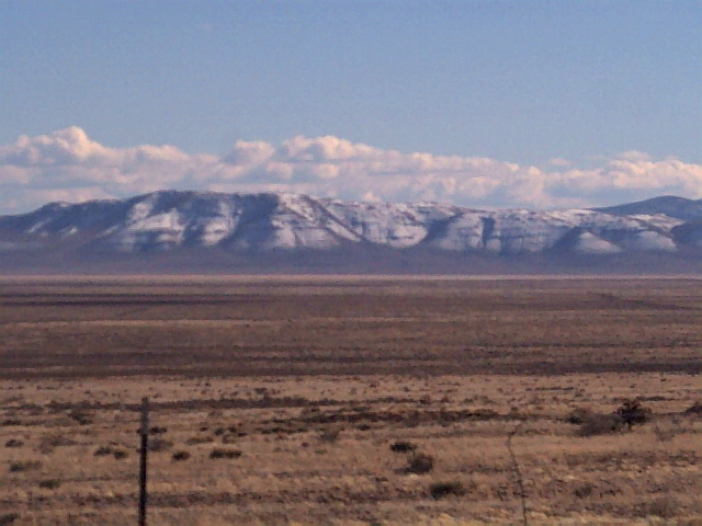
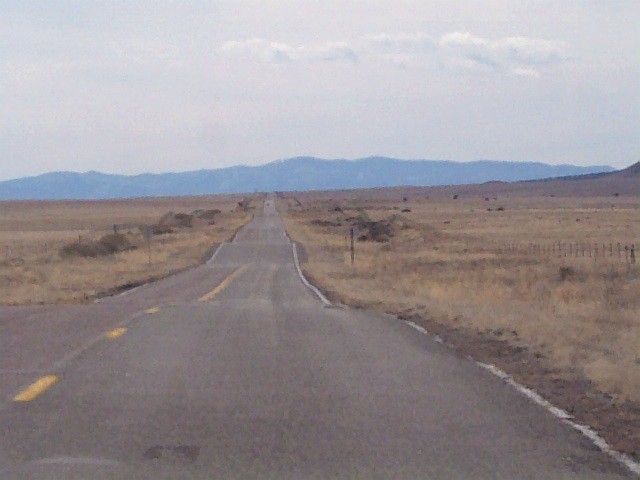
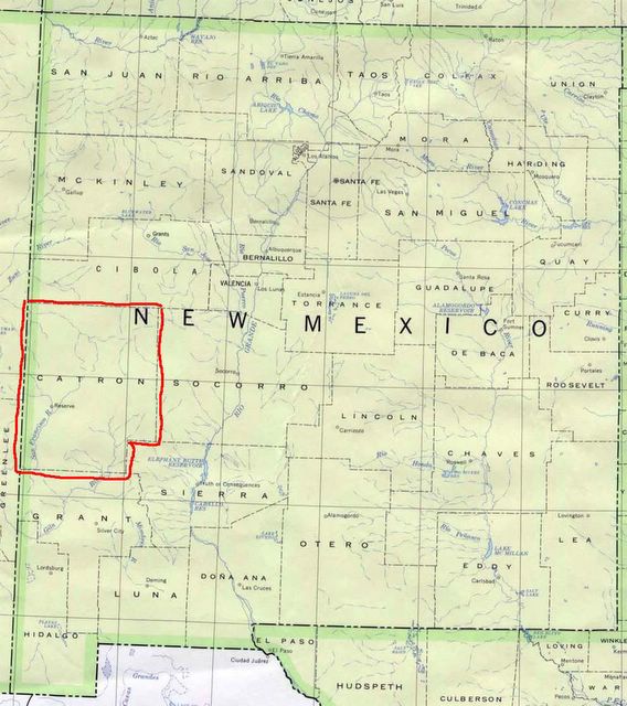
Monday the 21st - the kids wanted to visit a friend in Pleasanton, so we drove south and started our walk at the Grant county line. Once again the sky looked ominous, but it turned out to be perfect for walking. If you haven't been out here in the high desert country, it's hard to explain the quality of the light. I never saw anything like it back east. As we walked, the sun was shining in first one place then another, lighting up different parts of the landscape and throwing others into shadow. It was the kind of day when you're reminded how short a human life is, and how insignificant, compared to the size of the sky, and the centuries upon centuries of layers of rock exposed and carved by the wind.

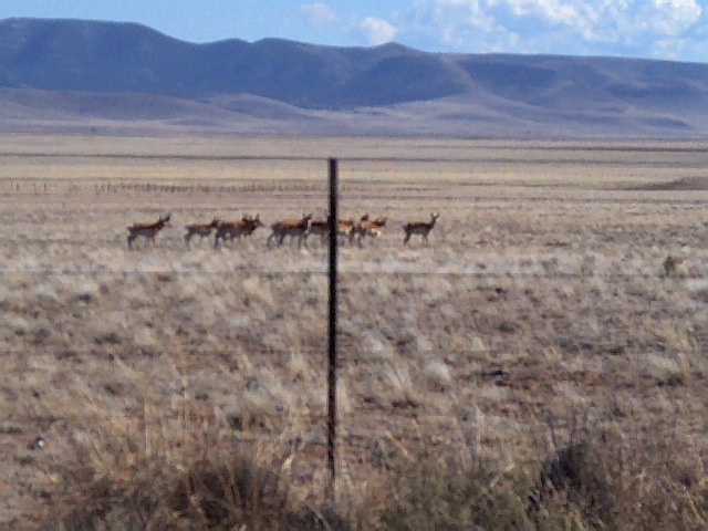
So we got in another 5.3 miles or so, lots of up and down and scrambling through the thorny mesquite whenever the highway was too narrow. It may be spring now, but the mesquite are showing no signs of believing it - Cynthia tells me they are the very last thing to green up, and when they do start to bloom, that's when winter will really be over.

Saw another golden eagle, perched on a roadkill by the highway near Reserve. Once again, not fast enough with the camera. When spring does come, the eagles will all go north.

... Posted by Hello

... Posted by Hello

... Posted by Hello

My poor pictures don't do justice to the scenery -
these are part of the Mogollon Mountains, seen
from 180 near the county line. Posted by Hello

Back on 180

Saturday the 18th - we drove out 12 to 180, set the trip meter to zero, and headed north. When we'd gone five miles we started looking for a place to park. It was an all downhill day, and a little nerve-wracking. Lots of twists and turns in the road and not much shoulder. You can't beat 180 for pretty, but it's not the safest place to be a pedestrian.

When I wasn't fearing for my life, though, I was enjoying seeing things that I'd never seen in all the many times I've driven this road. Because we've been having such a wet winter, there's water running everywhere, creating little waterfalls and collecting in pools. Very beautiful.

Friday, March 18, 2005


This is one of "our" bald eagles leaving the cottonwood tree where they like to hang out, taken last winter. Posted by Hello

Great Day for Birding

As I was driving out to meet Cynthia for a walk this morning, I saw an enormous golden eagle, probably female, and a much smaller bald eagle, probably male, circling each other over the duck pond. No camera, unfortunately. We have a pair of bald eagles that winter here - we've named them Hercules and Xena - and we see quite a few bald eagles in the area in the winter months, but hardly ever a golden eagle. I couldn't believe how huge it was! When I pulled out of the gate, it was just landing in the top of a tree across the highway, and when I got back, neither of them were in sight.

Last week we had a flock of seagulls here, and we've started to see redwing blackbirds, mountain bluebirds, kestrels, all the signs of spring.

The only wildlife we saw on our walk today was a squirrel, but we didn't walk too far - just the 2.7 miles of so we had left of 435. Most of our time today was spent scouting to see how much of Forest Road 141 is actually paved - the answer is, 18.8 miles of it. We're going to save it for later, when it's hot, since it'll be a lot cooler walking in the trees. It might be a good place to spot bear and mountain lion.

Thursday, March 17, 2005

We saw an elk cross the road...

...but we didn't get a picture. It was about 100 yards away, and it stopped and looked at us, but I didn't get the camera out in time. It was a perfect day for walking, and we got in our first 5 miles on 180 - all uphill. It felt good to get out walking after spending the weekend driving around in Albuquerque traffic.

Facing east on 180, about 5 miles south of where 12 starts. Posted by Hello

Friday, March 11, 2005


Hwy 180 from the Arizona state line down past Glenwood is probably next. Posted by Hello

Highway 12 Completed!

Yay! We've walked all 74.1 miles of 12. Finally the weather got nice, and we had some time, and now we have that warm fuzzy sense of accomplishment. Highways 32 and 12 combined add up to 119.6 miles. Including the 5 we walked around Reserve and the 6.5 we've walked on 435 so far, that makes 131.1 miles since January 1st.

Aaahh. Now this is what a New Mexico sky is supposed to look like! Posted by Hello

Not all the animals we saw on 12 were roadkill! Posted by Hello

Antelope. It's hard to get a good picture of them. When you stop your car, they bunch up and then start to take off. Posted by Hello

Back on Hwy 12, facing south. Posted by Hello

We Take A Break

After freezing ourselves to the bone near Datil, and walking another 5 mile section of 12 near Horse Springs, there were 11 days when we didn't walk at all. We are just a couple of ladies walking on paved roads and getting out of the house, not a couple of extreme explorers testing our limits. We have lives, and obligations, and medical procedures. Still, we missed it, and we were happy to get back to it.

Early on, we decided that a strict interpretation of our goal, to walk all the paved road in the county, meant walking the paved streets in the towns, not just the highways, so we spent an afternoon walking around Reserve. We estimated that we walked 5 miles, including the streets on the second mesa. We didn't have time to drive out and finish Hwy 12, so we started working on 435, which heads south out of Reserve past the sawmill and on down in the direction of Snow Lake and the Gila Wilderness. It's not all paved, but we think a good 20 miles of it might be, and we're going to start walking little chunks of it whenever we don't have time to drive farther.

Speaking of extreme adventurers, however, here's my book pick for the first week of March:

The Cloud Garden: A True Story of Adventure, Survival and Extreme Horticulture by Tom Hart Dyke and Paul Winder. This is the story of two idiots who, despite repeated warnings about the danger of being kidnapped, attempt to hike the Darien Gap from Panama to Columbia and get kidnapped. Through a combination of charm, loyalty to each other, and intelligence, they manage to stay alive until their kidnappers get thoroughly tired of them and tell them to go home. It's an incredible story, and will satisfy any need you might have to vicariously experience self-inflicted suffering in a jungle setting, replete with orchids and parasitic worms

From the sawmill, you can see the Reserve water towers. Posted by Hello

Behind the sawmill, you can see Forest Road 141 heading up the hill. Posted by Hello

Thursday, March 10, 2005


Looking south from 12 across the Plains of San Augustin. Posted by Hello

Looking north from Hwy 12, near the 54 mile marker - I think this might be called Wagon Tongue. Posted by Hello

Heading west on 12 between Datil and Horse Springs. Posted by Hello

Sleeting in Datil

2/12 - We had a little extra time, so we decided to drive out to where Hwy 12 runs into 60 at Datil, and work on 12 from that end, for a change of pace. The skies over Aragon didn't look too threatening, so we didn't bother with gloves, hats, those sensible things people bring along when they're walking in the middle of winter. By the time we got 15 miles away from Datil, we were noticing black clouds to the north, but we didn't worry too much. Weather around here usually moves west to east, and south to north, and I was expecting that the storm would move off in the direction of Albuquerque.

As soon as we started walking, it started raining. Neither of us wanted to be the one to chicken out. Within a mile, we were walking in hail. Datil is up around 8000' in altitude, so it was pretty cold. The other challenge was how hilly it was - up one steep hill and down the next all the way to Cynthia's truck, which was parked 7.7 miles away. We had about a mile where the wind and the rain eased up and we got a little bit warm, but the last three miles were just harsh - wind and sleet and icy rain, dripping off our jackets and soaking our pants' legs. The last mile my feet were completely soaked. Even the dogs were shivering. Because the wind was coming from the north, our right arms and hands were the ones that suffered most.

Lucky the Eagle Guest Ranch was open, and they had a roaring fire going in the fireplace.

The only traffic light in Catron County is here, in the town of Datil, where Hwy 12 ends. Posted by Hello

Wednesday, March 09, 2005

Mouse In A Can

On 2/11, I convinced my daughter to come with us, and pick up soda cans, out on Hwy 12 by Bursum Road. She filled her sack with cans, then we took a break while she lined them up on the edge of the road for Cynthia to flatten with her new hiking boots. We noticed that some of the cans had grass and twigs sticking out of them. Then my daughter noticed there was a mouse in the bottom of her sack. This mouse was dumped out by the roadside, and we continued walking, still picking up cans, but more carefully (we thought.)

When we got home, the kids finished crunching the cans, and stored them in the laundry room. Sometime after midnight, I heard shrieking. A mouse had somehow survived the can crunching, sobered up or come to his senses, and was trying to find his way out of the house. He was running around the kids' room, hence the cries of "There it is! There it is!" Everybody got up, but we couldn't find the mouse, so we all went back to bed.

A half hour later - "There it is! There it is!" and lots of banging and thumping as furniture was moved and objects were thrown. We got up again. Their dad wasn't having such a good time. "Get that worthless cat in here!" But the cat had no suggestions. It was decided to bring in the dogs. At this point they were sure the mouse was under the couch, so daughter#1 moved the couch while daughter#2 urged her pup forward. There it was! But there was also an old dog biscuit under there, and Callie must have decided that the biscuit was a surer thing, and less likely to fight back, 'cause she snagged it and made off with it.

We decided at that point to let all the dogs pile up on the kids' beds and worry about the mouse in the morning, but the mouse made a third appearance, and the BB gun came out, and that was that. But we learned something that we didn't know before. It seems that one man's trash is another's mansion - little mice crawl into the cans, drink the sugary pop left in the bottom, or the beer, and sometimes set up housekeeping and try to raise their little mousie families. It seems like there should be some sort of important message there, somewhere, but I can't think of it right now.

Momentum Carries Us Forward (for a little while.)

We were so psyched about finishing Hwy 32 that we knocked off the first 19 miles of Hwy12 in less than a week. Part of that was that we didn't have to drive nearly so far to get to the section we were walking.

Hwy 12 is a completely different walking experience from Hwy 32. For one thing, almost all the wildlife we're seeing is roadkill. (More cars.) It seems to be too cold still to see turkey vultures, but the roadkill disappears pretty quick anyway - probably the bald eagles are hauling it off. We've seen a couple of little red foxes, which I've never managed to spot out here before.

Along about the first week of February, our momentum faded. I had to go up to Albuquerque, and Cynthia took a trip to Tucson, and what with ski trips and bad weather, we didn't do so much walking. One the other hand, I got a lot of reading in.

Book Picks for the Month of February:

The Know-It-All: One Man's Quest to Become the Smartest Person in the World,
by A.J. Jacobs. This was pretty funny, in fact I couldn't put it down. You try writing a book about reading the Encyclopedia Britannica from cover to cover, and make it funny and compelling and somehow full of suspense.

The Dogs of Bedlam Farm, by Jon Katz. No dogs die in this book! Although there's still one place where you should have a box of tissue handy.

The Kite Runner, by Khaled Hosseini. I knew this was a work of fiction when I started to read it, but by the end I had completely forgotten that fact.

Cathedrals of the Flesh: My Search for the Perfect Bath, by Alexia Brue. It just goes to show, you never know what will turn up on the shelves of the Rural Bookmobile (without which I am sure I would wither and die.) This is a great travel book - you get to vicariously experience being scrubbed from head to toe with a coarse mitt by a nearly naked fat lady in a Turkish hamam in Istanbul, being flagellated with birch branches in a Russian banya, being a guest of the Finnish Sauna Society at Sauna Island, and steaming every last impurity out of yourself in a Japanese onsen resort. Reading this book has made a believer out of me - a frustrated believer, since I don't think I'll be going to Istanbul any time soon.

Meanwhile, back in the real world:

When we picked it up again, we started walking off the miles between Apache Creek and Datil. More roadkill - a raccoon, a javelina, and a burrowing owl. We crossed the Continental Divide on 2/9. Now we're out in the open again, with the Plains of San Augustin to our right.

In January We Were So Dedicated...

Our first walk was 5 miles on Hwy 32 in icy cold rain. We were miserable, but cheerful. We'll walk in all weathers! Rain? Snow? We don't care! We originally planned to walk once or twice a week, averaging 10 miles a week. We got maps and started marking off our progress, and started walking three times a week. It was becoming addictive. Cynthia bought new hiking boots and we took pictures of them.

Not far from Apache Creek we saw a roadrunner cross the road, another day it was a coyote crossing the highway south of Jewett Road. We started bringing dogs and children and picnic lunches. One very cold day, not far from the road that goes to Hardcastle Gap we stopped and watched a midair dispute between two redtail hawks for ten minutes, and near the rest area north of the turn off to Slaughter Mesa, there were five mule deer grazing just off the road. North of Quemado Lake we saw a bald eagle being mobbed by crows.

We finished Hwy 32 on my birthday, walking 8.5 miles. Including the 3.9 miles of pavement that goes from 32 to Quemado Lake, our total so far: 45.5 miles.

Tuesday, March 01, 2005

How We Got Started

Back in December of 2004, I came across an article in The New Yorker about a guy named Caleb Smith who systematically walked every street on the island of Manhattan. I kept thinking about this, and on a New Year's Day hayride I announced to all and sundry my New Year's Resolution: to walk every paved mile of Catron County.

Not everybody was impressed. One person, however, came over and said "Sounds like a neat idea. Would you like some company?" We started walking the next day.

Here's a link to Caleb's fun and interesting website about his New York City Walk:http://www.newyorkcitywalk.com

New Mexico - Land of Enchantment Posted by Hello

Catron County - highlighted in green are the bits we've walked so far Posted by Hello